About Our Atmosphere
The Level-1 and Atmosphere Archive & Distribution System (LAADS) Distributed Active Archive Center (DAAC) at the Goddard Space Flight Center (GSFC) is one of the data centers that primarily serves atmosphere data and derived data products. The other DAACs that provide atmospheric data include the Atmospheric Science Data Center , the Goddard Earth Sciences Data and Information Services Center , and the Global Hydrometeorology Resource Center. Scientists use these datasets to study Earth's atmosphere — one of the three primordial elements that sustain all life-support systems in our biosphere. This section answers four fundamental questions to introduce the LAADS DAAC’s discipline domain:
- What is Earth’s Atmosphere?
- Why should we study Earth’s atmosphere?
- What role does remote sensing data play in studying Earth’s atmosphere?
- How do the LAADS DAAC atmosphere products differ from the atmosphere products offered at the other DAACs?
What is Earth's atmosphere?
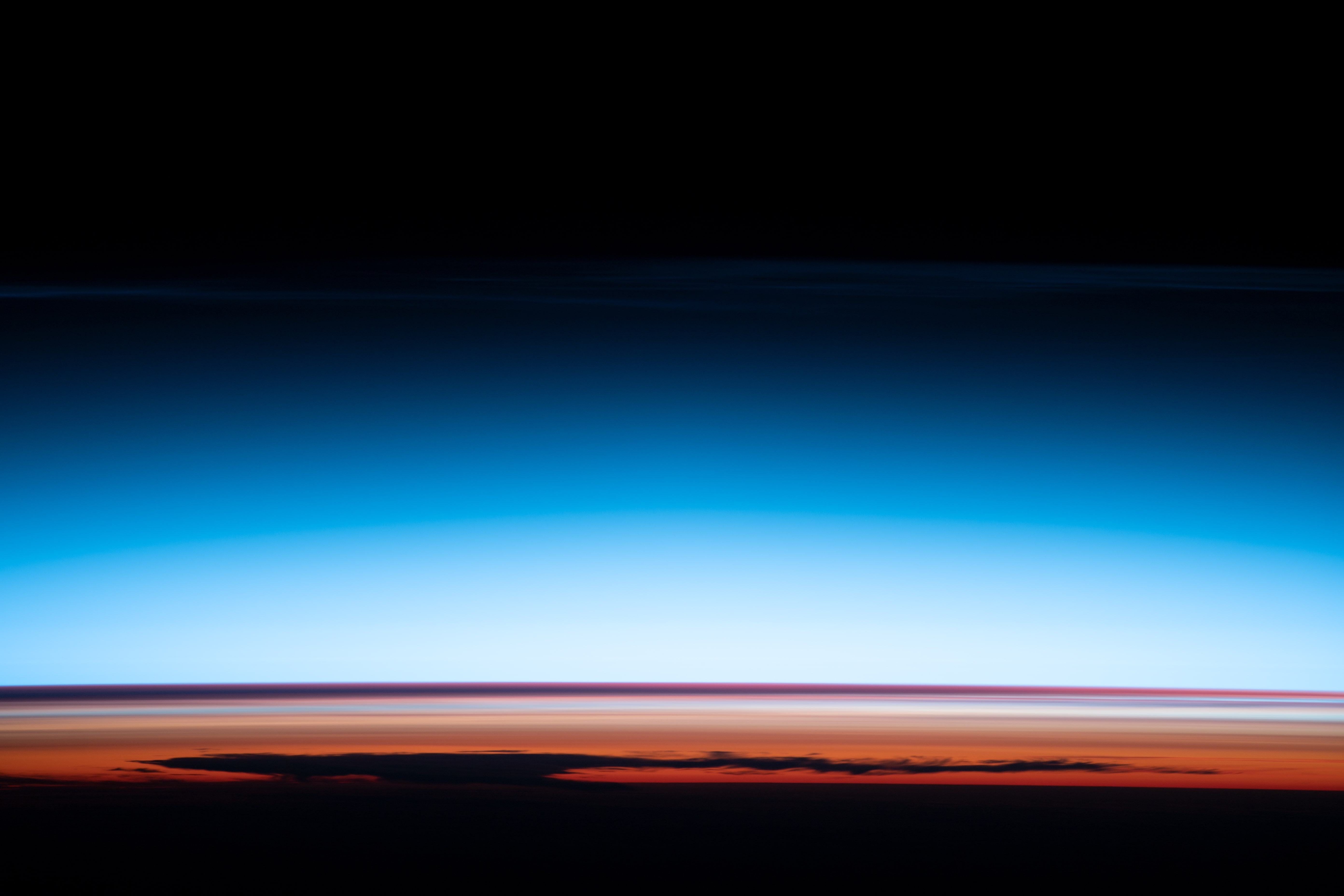
Earth's atmosphere is a universal envelope of gases that act as a protective shield to sustain all biospheric life on the planet. It helps absorb ultraviolet radiation from the Sun, and maintains the natural greenhouse effect that helps render a habitable Earth in the “Goldilocks Zone.” Earth’s atmosphere is one of the integral elements of the global ecological system that constantly interacts and exchanges with its other two elements: lithosphere and hydrosphere.
We can visualize Earth’s atmosphere as layers that change with altitude. The layers include the troposphere, stratosphere, mesosphere, thermosphere, and exosphere. Earth’s atmosphere, since its forming roughly 5 billion years ago, has evolved considerably to its current state and composition. It contains a number of components that Earth scientists study both as researchers and applied scientists. They include atmospheric aerosols, water vapor, ozone, temperature, moisture, and clouds. These components also form the foundation for LAADS DAAC’s data products’ portfolio.
Why should we study our Earth's atmosphere?
Our Earth’s atmosphere plays an increasingly important role within several contemporary planetary scale environmental problems. Understanding its structure and dynamics, and its interactions with Earth's other systems , is a critical prerequisite before we can formulate objective solutions to address such problems. The Anthropocene era is defined as the time epoch that roughly began with the Industrial Revolution in the late-eighteenth century. This time period also marks the beginning when the influences of human activities on Earth's atmosphere became recognizable, and ever since, have been on the rise. Since then, greenhouse gases, air pollution, ozone depletion, and acid rain constitute some of the critical problems that have impacted Earth's atmosphere, and continue to contribute to the growing debate on global warming and climate change. For more information on why NASA studies the atmosphere, visit: https://climate.nasa.gov/news/2921/nasas-role-in-studying-earths-atmosphere/.
What role does remote sensing data play in studying Earth’s atmosphere?
Space-based remote sensing enables us to gather observations about atmospheric, terrestrial, and oceanic elements of our Earth's biosphere in ways that are nearly impossible to replicate using ground-based methods. Earth's life-support systems are driven by the dominant Sun, and remote sensing attempts to observe and measure the Sun's energy in its various manifestations. Radiative forcing is the difference between the incoming solar radiation energy that is absorbed by Earth and radiated back into space. This delicate radiation balance is critical in determining Earth's average temperature and is affected by several factors including: the intensity of solar radiation, atmospheric composition, aerosols, cloud cover, and greenhouse gases, albedo or reflectivity of different surfaces, snow-cover, vegetation, and land-use patterns.
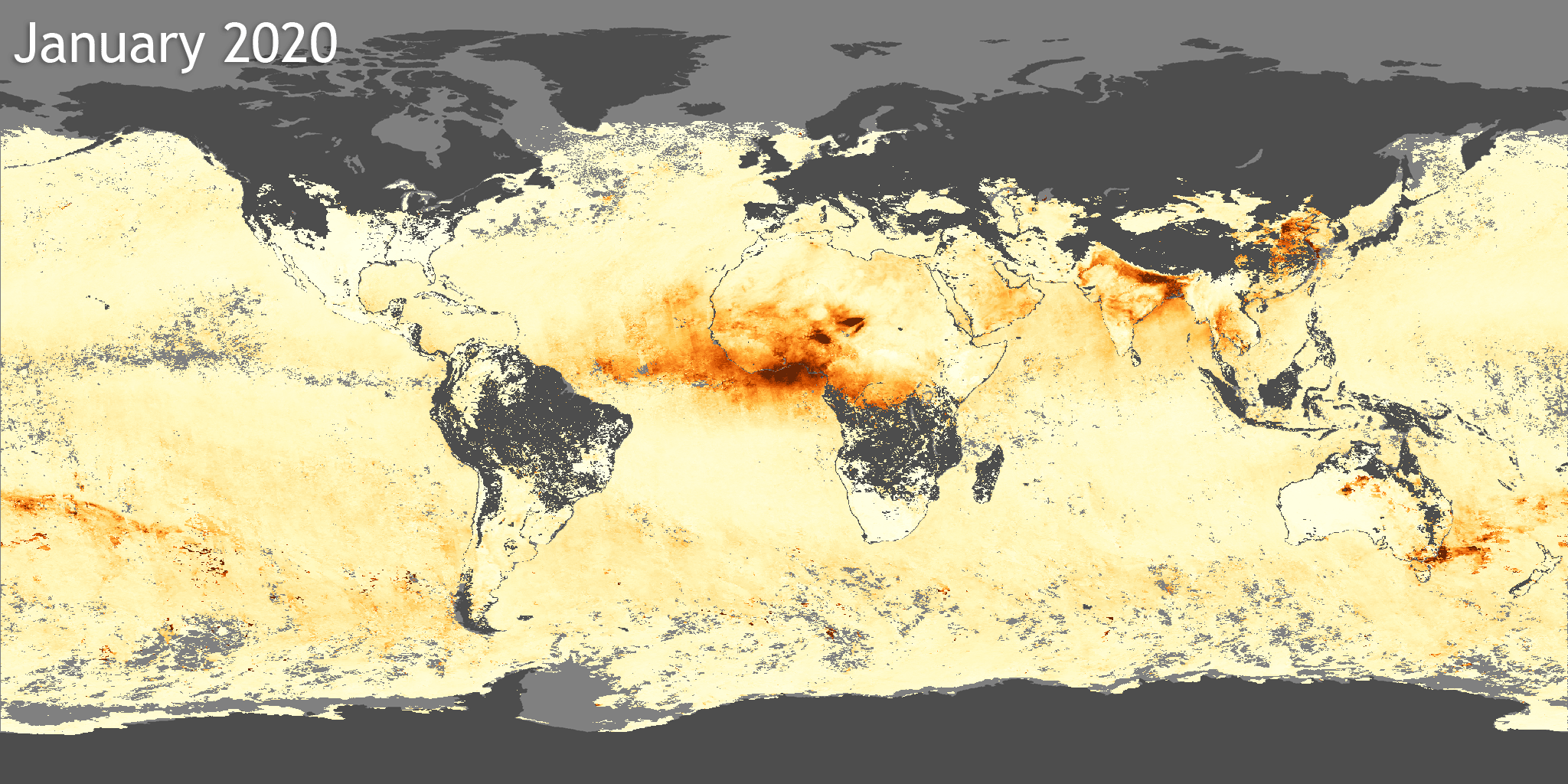
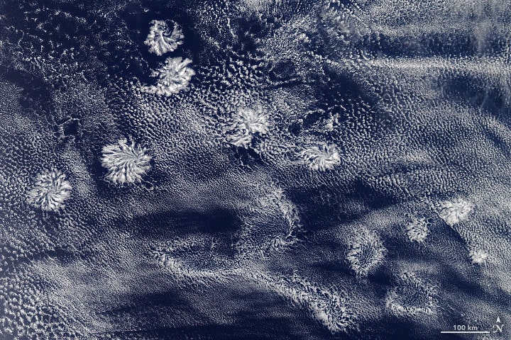
There are three major exchange cycles that drive our understanding of Earth's environmental dynamics, and remote sensing-derived data provide an efficient mechanism to observe and measure their attributes and behavior. They include the global energy budget, hydrological cycle, and carbon cycle. The energy budget involves solar heating, IR cooling, and the transport of heat between the surface and the atmosphere. Heat is also transported from equator to poles by the atmosphere and ocean. Clouds are evidence of moisture fluxes transported vertically from the surface to varying atmospheric levels and transported horizontally by wind advection. Aerosol plumes are a signature for both natural (volcanic, dust) and anthropogenic (coal burning, deforestation) processes, with the latter contributing prominently to the carbon cycle as sources of atmospheric CO2. Moderate Resolution Imaging Spectroradiometer (MODIS)-derived datasets play a key role in monitoring how the atmosphere responds to various forcings, whether from new volcanic eruptions, sea surface temperature changes, new land use patterns or increasing greenhouse gas concentrations. They also help scientists characterize the many natural oscillations of the coupled atmosphere-ocean system including, El Niño Southern Oscillation, seasonal monsoons, and Arctic/northern hemisphere anomalies.
The LAADS DAAC produces and serves a complement of atmosphere product collections from two major flagship Earth science missions: NASA Earth Observing System's Terra and Aqua MODIS, and Suomi National Polar-orbiting Partnership (SNPP) and Joint Polar Satellite System’s Visible Infrared Imaging Radiometer Suite (VIIRS).
How do the LAADS DAAC atmosphere products differ from the atmosphere products offered at the other DAACs?
There are four DAACs in the atmospheric science domain: LAADS, Goddard Earth Sciences Data and Information Services Center (GES DISC) , Atmospheric Science Data Center (ASDC) , and the Global Hydrometerology Resource Center (GHRC) . Each host and serve a variety of atmosphere products that demonstrate not only the wide range among them, but also the unique tools and services offered to their users.
The following table provides a broad example to show the disciplines or sub-disciplines that each of the data centers cater to under the common atmospheric science domain. The variety of satellite and airborne missions, field campaigns, and field experiments are not reflected in this table. Also, the discipline categories identified below are not mutually exclusive. Please visit each DAAC site to understand the full complement of their holdings, tools, and services, and the nuances that distinguish them.
| Science Disciplines | LAADS | GES-DISC | ASDC | GHRC |
|---|---|---|---|---|
| Aerosols | ||||
| Clouds | ||||
| Water Vapor | ||||
| Temperature | ||||
| Ozone | ||||
| Hurricanes | ||||
| Moisture | ||||
| Precipitation | ||||
| Tropospheric Chemistry | ||||
| Radiation Budget | ||||
| Lightning |
| LAADS | GES-DISC | ASDC | GHRC |
|---|---|---|---|
| Aerosols | Aerosols | Aerosols | Aerosols |
| Clouds | Clouds | Clouds | Clouds |
| Water vapor | Water vapor | Water vapor | Water vapor |
| Temperature | Temperature | Temperature | Temperature |
| Ozone | Ozone | Ozone | Hurricanes |
| Moisture | Precipitation | Tropospheric Chemistry | Precipitation |
| Radiation Budget | Lightning |
Last updated: June 11, 2021